![](/images/other/stat-length.png)
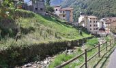
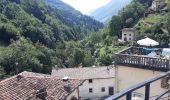
![Tocht Te voet Selva di Progno - Giazza - Tàmbaro bivio 281 - Photo](https://media.geolcdn.com/t/1900/400/83a31790-dc1e-4af9-b4ba-530f507478c5.jpeg&format=pjpeg&maxdim=2)
Giazza - Tàmbaro bivio 281
SityTrail - itinéraires balisés pédestres
Tous les sentiers balisés d’Europe GUIDE+
![Lengte](/images/other/stat-length.png)
![Max. hoogte](https://static1.geolcdn.com/siteimages/upload/files/1508320355ic_sort_altitude_max_24dp.png)
![Positief hoogteverschil](https://static1.geolcdn.com/siteimages/upload/files/1508320355ic_sort_den_pos_24dp.png)
![Km-Effort](/images/other/stat-length.png)
![Min. hoogte](https://static1.geolcdn.com/siteimages/upload/files/1508320355ic_sort_altitude_min_24dp.png)
![Negatief hoogteverschil](https://static1.geolcdn.com/siteimages/upload/files/1508320355ic_sort_den_neg_24dp.png)
![Boucle](https://static1.geolcdn.com/siteimages/upload/files/16400158638029165_repeat_loop_refresh_sync_direction_icon.png)
![Te voet](https://static1.geolcdn.com/sitytour/trail-icons/100.png)
2h40
Moeilijkheid : Gemakkelijk
![Scan deze QR-code om de tocht te openen in de SityTrail-applicatie](https://capi.geolives.com/qq0zvz2zws4bq2lad0pu/sitytour/trails/3113266/qr.png?size=200)
Gratisgps-wandelapplicatie
Over ons
Tocht Te voet van 4 km beschikbaar op Veneto, Verona, Selva di Progno. Deze tocht wordt voorgesteld door SityTrail - itinéraires balisés pédestres.
Beschrijving
Trail created by Club Alpino Italiano Sezione di Tregnago.
Relation mantained by Club Alpino Italiano Sezione di Tregnago, before making changes contact the CAI structure
Symbol: 282 on white red flag
Plaatsbepaling
Opmerkingen
Wandeltochten in de omgeving
![Tocht Te voet Velo Veronese - Dorsale Media della Lessinia - sezione Camposilvano - Bernardi - Photo](https://media.geolcdn.com/t/375/260/641701ec-d3e5-4bb8-8c62-b4640e9f9d40.jpeg&format=jpg&maxdim=2)
![Te voet Te voet](https://static1.geolcdn.com/sitytour/trail-icons/100.png)
Te voet
![](/images/other/stat-length.png)
![](https://static1.geolcdn.com/siteimages/upload/files/16400158638029165_repeat_loop_refresh_sync_direction_icon.png)
![Tocht Te voet Selva di Progno - Dorsale Alta della Lessinia tratto Giazza - Parparo di Sopra - Photo](https://media.geolcdn.com/t/375/260/cb54e536-35e4-4e19-ace6-4e6223d7511e.jpeg&format=jpg&maxdim=2)
![Te voet Te voet](https://static1.geolcdn.com/sitytour/trail-icons/100.png)
Te voet
![](/images/other/stat-length.png)
![](https://static1.geolcdn.com/siteimages/upload/files/16400158638029165_repeat_loop_refresh_sync_direction_icon.png)
![Tocht Te voet Roverè Veronese - Genderli bivio 252 - Malga Parparo di Sopra - Photo](https://media.geolcdn.com/t/375/260/cb54e536-35e4-4e19-ace6-4e6223d7511e.jpeg&format=jpg&maxdim=2)
![Te voet Te voet](https://static1.geolcdn.com/sitytour/trail-icons/100.png)
Te voet
![](/images/other/stat-length.png)
![](https://static1.geolcdn.com/siteimages/upload/files/16400158638029165_repeat_loop_refresh_sync_direction_icon.png)
![Tocht Te voet Crespadoro - 215 - Photo](https://media.geolcdn.com/t/375/260/3f985bbe-a1c9-439d-a48e-8466bd528543.jpeg&format=jpg&maxdim=2)
![Te voet Te voet](https://static1.geolcdn.com/sitytour/trail-icons/100.png)
![Tocht Te voet Crespadoro - Anello Ecoturistico Piccole Dolomiti - Photo](https://media.geolcdn.com/t/375/260/53110be4-ca56-4dc7-ab46-c4a553067ed7.jpeg&format=jpg&maxdim=2)
![Te voet Te voet](https://static1.geolcdn.com/sitytour/trail-icons/100.png)
Te voet
![](/images/other/stat-length.png)
![](https://static1.geolcdn.com/siteimages/upload/files/16400158638029165_repeat_loop_refresh_sync_direction_icon.png)
![Tocht Te voet Crespadoro - Anello Ecoturistico Piccole Dolomiti 003 - Photo](https://media.geolcdn.com/t/375/260/3d813d6a-80e7-41f0-a457-8e0b75a76092.jpeg&format=jpg&maxdim=2)
![Te voet Te voet](https://static1.geolcdn.com/sitytour/trail-icons/100.png)
Te voet
![](/images/other/stat-length.png)
![](https://static1.geolcdn.com/siteimages/upload/files/16400158638029165_repeat_loop_refresh_sync_direction_icon.png)
![Tocht Te voet Bosco Chiesanuova - Pissarotta ponte SP 15 - San Giorgio - Photo](https://media.geolcdn.com/t/375/260/ef01f4c8-3e9b-4e33-af57-6e5037d69b69.jpeg&format=jpg&maxdim=2)
![Te voet Te voet](https://static1.geolcdn.com/sitytour/trail-icons/100.png)
Te voet
![](/images/other/stat-length.png)
![](https://static1.geolcdn.com/siteimages/upload/files/16400158638029165_repeat_loop_refresh_sync_direction_icon.png)
![Tocht Te voet Selva di Progno - Dorsale Media della Lessinia - sezione Campofontana - Camposilvano - Photo](https://media.geolcdn.com/t/375/260/544a9a2d-d927-47f3-b72d-2fb12acc86c9.jpeg&format=jpg&maxdim=2)
![Te voet Te voet](https://static1.geolcdn.com/sitytour/trail-icons/100.png)
Te voet
![](/images/other/stat-length.png)
![](https://static1.geolcdn.com/siteimages/upload/files/16400158638029165_repeat_loop_refresh_sync_direction_icon.png)
![Tocht Te voet Selva di Progno - Giazza - Colonia estiva - nei pressi passo Zevola - inn. sent. 202 - Photo](https://media.geolcdn.com/t/375/260/83a31790-dc1e-4af9-b4ba-530f507478c5.jpeg&format=jpg&maxdim=2)
![Te voet Te voet](https://static1.geolcdn.com/sitytour/trail-icons/100.png)
Te voet
![](/images/other/stat-length.png)
![](https://static1.geolcdn.com/siteimages/upload/files/16400158638029165_repeat_loop_refresh_sync_direction_icon.png)